National EPA

DRAFT FOR CONSULTATION

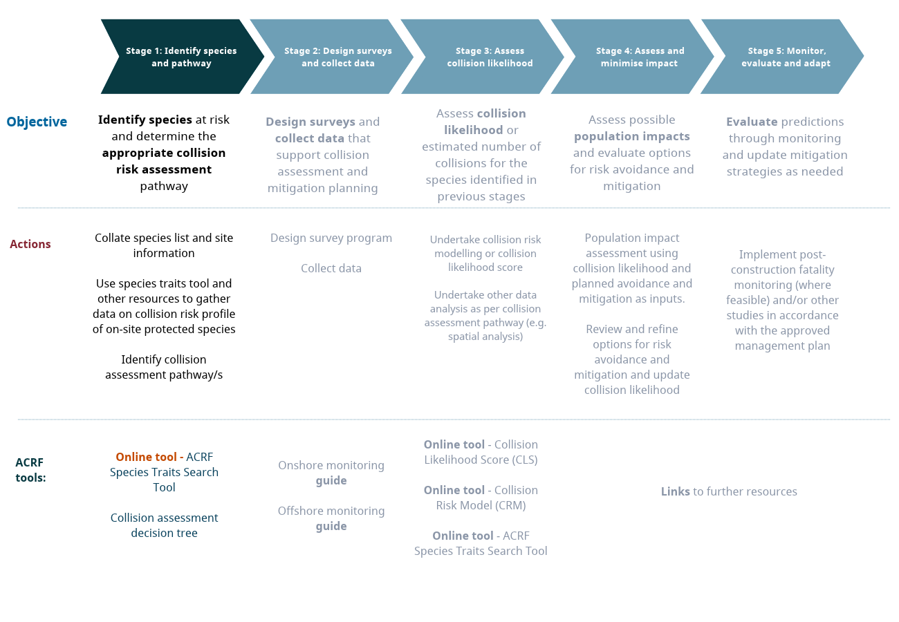
Stage 1: Identify species and pathway

Stage 1: Identify species and pathway

Identify species at risk and determine the appropriate collision risk assessment pathway. Understand more about collision risk and document collision factors for specific species.

Objective and scope

Identifying species that may be at risk of collision and selecting the appropriate collision likelihood assessment pathway are the first steps in applying the ACRF. Early assessment helps ensure that subsequent surveys and assessment methods are proportionate, targeted, and fit for purpose.The aim is not to quantify collision likelihood at this stage; but to understand if avoiding or mitigating collision risk will be a major factor in the development of a particular site.

Key questions: Which bird or bat species may occur within or use the project area? Which bird or bat species may be susceptible to collision? What evidence is available to assess collision likelihood? What are the key information gaps and uncertainties? Which assessment pathway is appropriate: CRM, CLS, or hybrid?

Spatial scope: Regional and project-level assessment, including site selection, project siting and inter-site prioritisation.

Project timing: As early as practicable during site selection and constraints mapping, and preferably before substantial resources are committed to field surveys.

Key Activities:

  • Compile species and site information
  • Review available data on collision risk criteria and identify data gaps
  • Assess feasibility of the collision likelihood assessment pathways
  • Select and document the collision likelihood assessment pathway
  • Outputs:

  • Species and site assessment: A documented list of species that may occur within or use the project area and relevant surrounding area, including the evidence sources used.
  • Evidence review: A documented review of available evidence relevant to the collision likelihood criteria, including key uncertainties and information gaps.
  • Pathway feasibility assessment: A documented assessment of the feasibility and proportionality of CRM, CLS and hybrid approaches for each relevant species or species group.
  • Pathway selection: A documented collision likelihood assessment pathway for each relevant species or species group, including the rationale for the selection.
  • Survey and data requirements: A documented set of survey and data requirements arising from Stage 1, including the key questions or uncertainties they are intended to address.
  • Objective and scope
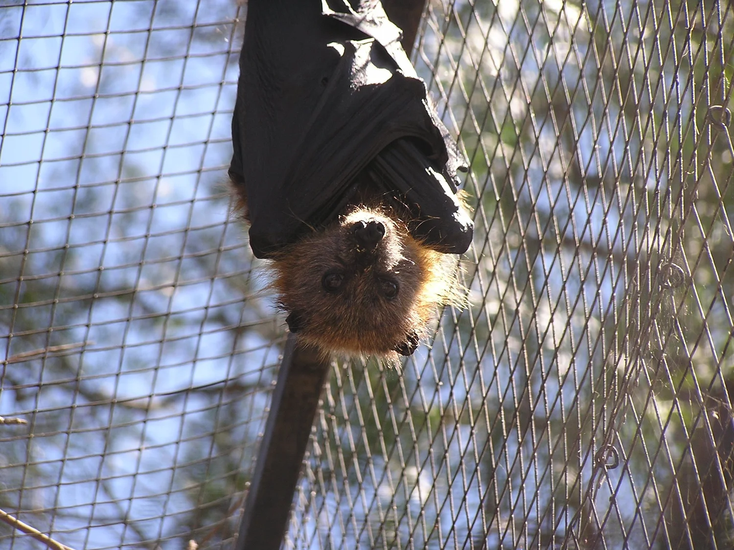
    Photo by Symbolix

    Documents and applications

  • ACRF Guidance document provides detailed information to help navigate this stage and the ACRF as a whole
  • Species Traits Search Application - Interactive database providing standardised collision risk trait data for EPBC-listed, migratory, and marine flyover species. Search by species name to access morphological data (for CRM inputs), flight behaviour characteristics, and temporal activity patterns. The tool clearly indicates where information gaps exist.
  • Third party resources

    Information on the broader commonwealth impact assessment process

  • EPBC Act publications and resources
  • Protected matters search tool
  • Updated Guidance on offshore renewables environmental approvals
  • Species sensitivity mapping and assessment of collision population impacts:
  • AVISTEP
  • Reid K. and Baker, B. 2025 Impacts on birds and bats from onshore wind farms in Australia
  • Reid K. and Baker, B. 2025 Impacts on birds and bats from offshore wind farms in Australia
  • eBird - Cornell Lab of Ornithology's global bird observation database, useful for species occurrence records and distribution data.
  • Other Resources
  • Third party resources
    Photo by Eco Aerial